Satellite Miners
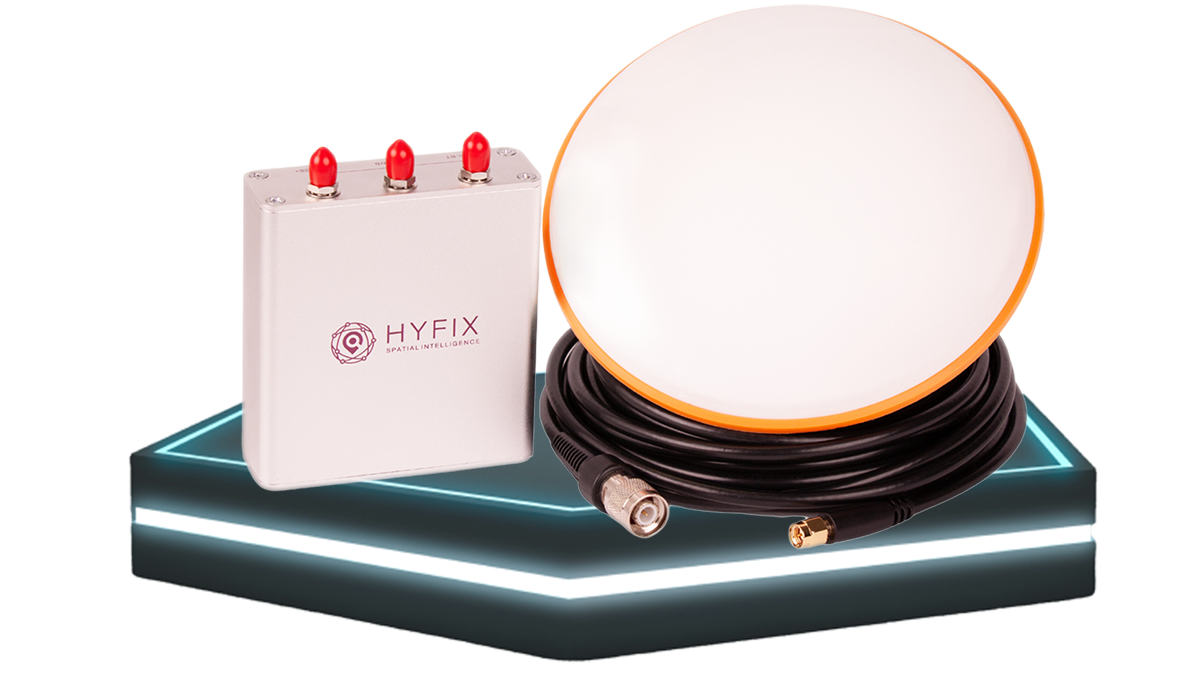
The GEODNET network comprises reference stations known as Satellite Miners, which receive signals from the Global Navigation Satellite Systems (GNSS). Each Satellite Miner is capable of delivering precise RTK correction data through the GEODNET network to all devices situated within a range of approximately 20-40 kilometers. Devices that connect to the GEODNET network to access enhanced accuracy data are referred to as “Rovers.” A rover can be any device equipped with a GNSS receiver, such as a car, drone, mobile phone, or tractor.
The received signals are uploaded to the GEODNET network via the Internet, and the Rover devices utilize the data to correct for space weather and other satellite errors. Each station uploads approximately 10-20 GB of mined data per month.
Certified GEODNET Miner Distributors
| COMPANY | EXPERTISE | REGION | ||
|---|---|---|---|---|
High-Precision IoT Products | Global | BUY | ||
GEODNET Support, Agriculture & Scientific Applications | EU, Eastern Europe | BUY | ||
DePIN Networks | Turkey, MEA | BUY | ||
Drones, LiDAR Scanning | Global | BUY | ||
GEODNET Mining, RTK Service, Location Hosting | EU, New Service Regions | BUY | ||
web3 IoT Projects, DePIN | Canada | BUY | ||
LoRaWAN, GNSS, Location Hosting in India | India | BUY | ||
Surveying | North America | BUY | ||
DePIN, Crypto Mining | Netherlands | BUY | ||
DePIN, DeWi | ASIA | BUY |


RTK Service
The GEODNET Network comprises thousands of triple-frequency, full-constellation GNSS reference stations installed globally. Achieving centimeter-accurate RTK-fix is made easy by GEODNET, with its continuously expanding coverage map.
Each GEODNET station features a geodetic-grade antenna calibrated by the United States National Geodetic Survey. All stations undergo 24x7 monitoring and are positioned with Precise Point Positioning (PPP). The GEODNET network provides data through the NTRIP protocol and adheres to the internationally accepted RTCM3.2 protocol. GEODNET's service is highly compatible with a wide range of user equipment.
Equipment compatibility table
Compatible with thousands of GNSS Receivers


The GEODNET Network offers free
GEODNET Service Partners and Resellers
Commercial GEODNET services are delivered to various markets, applications, and OEMs through distribution and resale partners.
Distribution partners may acquire GEODNET station data in two business models:
• Wholesale/OEM with a fixed cost/station
• Network Resale with 50/50 revenue-share
Raw GNSS Data
The GEODNET Network operates a global backbone station network to supply data to leading precision GNSS organizations. Providing worldwide coverage simultaneously fuels research and development for new and emerging innovations.
Working with data at a global scale from highly reliable station feeds evenly distributed over the Earth's surface is something which cannot be generated in simulations. GEODNET has established a state-of-the-art backbone network based on the Hemisphere P40 GNSS receiver. Each global backbone station is equipped with cellular 4G and battery backup, along with a primary wired Internet connection.
GEODNET collaborates with leading experts in global GNSS processing and software, particularly in orbit, clock, and ionospheric modeling.
Some of our esteemed partners include:
GEODNET uses NRCAN's CSRS-PPP service as an integral part of its station positioning and monitoring.